 geo.be Metadata Catalog
National Geographic Institute
Type of resources
Available actions
Topics
INSPIRE themes
federalThemes
Keywords
Contact for the resource
Provided by
Years
Formats
Representation types
Update frequencies
status
Service types
Scale
Resolution
-
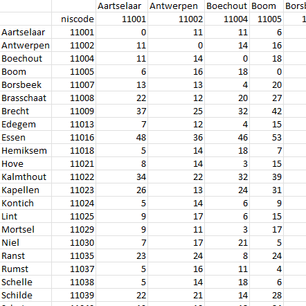
This dataset contains a matrix of distances between all Belgian municipality centres as defined in the AdminVector product. The distance is in km and is rounded to an integer.
-

MapIndex is a regular grid of rectangular or square cells coded with alphanumeric characters. It has been defined for the Belgian territory and allows geolacating several events. The present version is a beta (v2)version which is submitted to the emergency services. It will evolve to a standard cartographic grid.
-

This web service allows downloading datasets from CORINE Land Cover-2018-Belgium, compliant with the INSPIRE data specifications
-
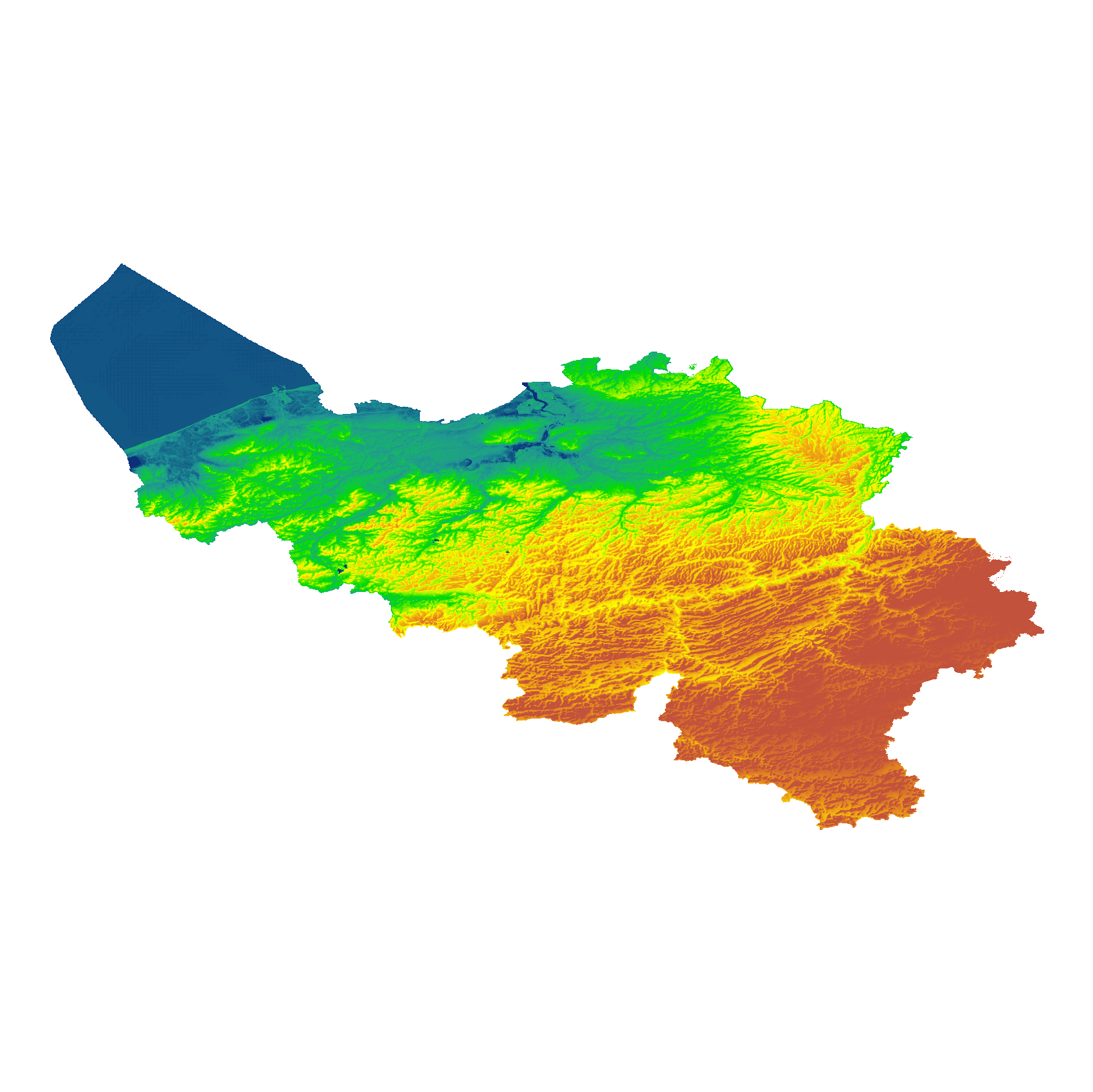
The eTOD digital terrain model (DTM) is a homogeneous and regular point grid indicating the elevation of the ground level in order to make a model of its surface. This DTM is obtained by resampling raw altimetric source data from the Flemish and Walloon Regions, grouped in Lambert 72 and with a resolution of 1 m; as well as data obtained internally by direct photogrammetric recording of structure points and lines based on the most recent aerial photographs for all areas not covered by regional data. For this DTM, the resolution and coordinate reference system are used as defined by the eTOD specifications.
-
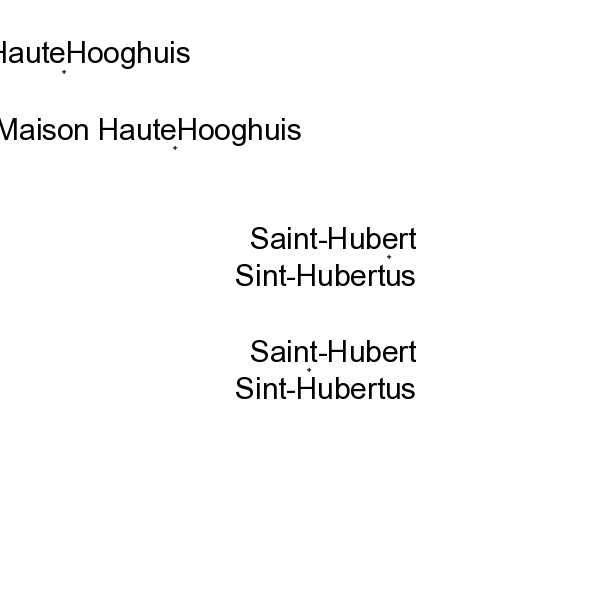
The layer Geographical Names includes all the names of administrative units, uninhabited places, waterways, remarkable buildings and infrastructures. They are classified into different feature and attribute classes.
-

This dataset contains the orthophotos of the floodable areas along the Meuse, the Vesdre and the Demer. These orthophotos are digital aerial photographs, taken by Hansa Luftbild following the floods of July 2021, in which the systematic distortions due to the central projection, relief and the not always perfectly vertical axis of shooting have been corrected. The orthophoto thereby obtained is metrically more accurate than an ordinary aerial photograph and is highly valuable as basic information. The resolution of the data is 6.5 cm (4 cm above the Hoëgne).
-
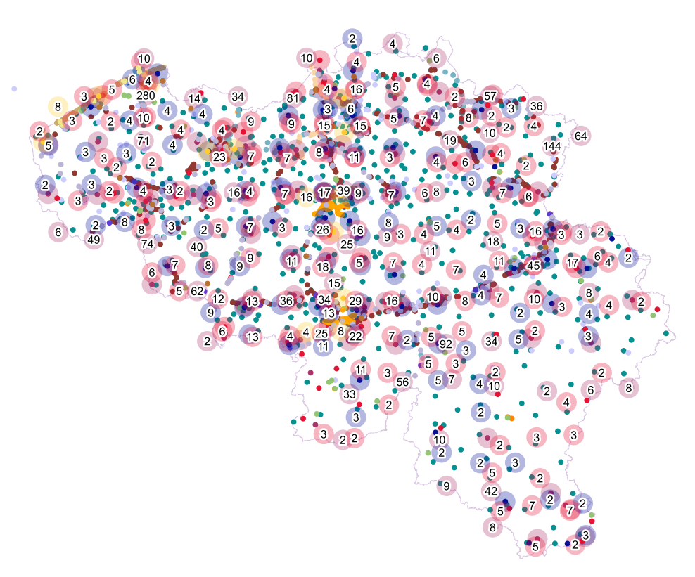
Points Of Interest - Infrastructures interest contains point elements indicating the location of a infrastructure, such as a container depot, incinerator, brunnel (bridges and tunnels), rail traffic, subway access, subway and tram stops, heli- and airport, control tower, light mast, lighthouse, water tower, flashing-lamp, breakwater, harbour area, marina, ship lift, dock, embankment, sluice, stilt structure and water point in Belgium.
-

This web service allows viewing datasets from Buildings
-

Top10Vector – Local topography is the data set of the Belgian orography. This data set includes eight classes. First class: earth banks. Second class: additional geometry of the slope surface. Third class: dune zone. Fourth class: historic mounds. Fifht class: cave entrances. Sixth class: cone-shaped slag heap. Seventh class: steep. Eightth class: embanlments. This data set can be bought via the corresponding hyperlink.
-

Landuse-Particular Zone is the INSPIRE 2D vector data set of the "Particular zones" layer originated from the Top10vector product of the National Geographic Institute in Belgium . It includes the "ExistingLandUseDataSet" features and the "ExistingLandUseObject" features in accordance with the INSPIRE specifications.